

Cyprus Shores / Cottons Beach
The beach at Cyprus Shores has experienced the most rapid, extensive erosion of any beach in San Clemente.

Over 200 feet of beach width and almost 20 feet of vertical height has been eroded from this beach, mostly over just the last three years.  Only a few hundred feet of beach remain north of the pedestrian tunnel. The erosion to "zero beach" continues to advance northward; currently there is no dry sand at the northern boundary of the private beach (southern boundary of San Clemente State Beach).

ARMORING: OCTA has established a rock revetment across the entire beach, adding many tens of thousands of tons of rock between 2020-23. Most of the revetment is 20-30 feet wide, up to 20 feet high, and within OCTA's Right of Way (ROW) which extends 50 feet on either side of the tracks. A landslide that began in October 2020 triggered the placement of additional rock extending about 70 feet out across about 700 feet of coastline. However, the majority of the rock recently added lies outside of the landslide area.

UNIQUE CHALLENGES: The landslide revetment acts as a groin, capturing longshore drift. Because longshore drift in this area is bidirectional, when sand drifts southward in the winter it accumulates on the north side of the Landslide Revetment. However, when the more southerly south swells begin in the summer, the sand moves northward, eroding the winter (wet sand) beach. Sand coming north from San Mateo Creek area is blocked by the Landslide Revetment, leaving the beach sediment-starved.  Furthermore, waves crashing against the rock revetment have accelerated erosion such that the slope of the seafloor in front of the revetment is excessively steep.

SEDIMENT CHARACTERISTICS: Most of the sand is underwater. The remaining wet sandy beach is composed of medium-to coarse-grained sand, with an offshore cobble field and periodically-appearing cobble cusps.

INFRASTRUCTURE: Previously the Cyprus Shores Community Association had several volleyball nets, a shower, picnic tables and fire pits. All of these have been destroyed. The pedestrian underpass beneath the railroad is underwater much of the year and is threatened by undermining.

PUBLIC ACCESS: Before 2020, lateral public access existed below mean high tide elevation, and served as a direct connection between San Clemente and San Onofre State Beaches. Subsequent to the emplacement of the OCTA rock revetment, people can no longer walk along the wet sand to transit the two parks, and instead are forced onto the rail line. Save Our Beaches SC has developed a plan to re-establish this connection and restore the viability of the California Coastal Trail at this location.

SURF RESOURCES: The world-renowned Cottons surf break is present at the south end of the beach. This break is characterized by a rocky reef that is usually covered with sand bars. Due to the lack of sand input, those sand bars are disappearing and the surf quality has deteriorated. Additionally, the revetments create reflected waves and backwash which interferes with the natural surf break. SOBs joins with Surfrider Foundation in calling for OCTA to study the impacts of this revetment on this valuable surf resource.
RESTORATION PLAN: SOBs has developed a short-term plan that requires OCTA to re-establish public access along this beach between the pedestrian tunnels at the State Beach campground and at Cyprus Shores. Long-term restoration will require significant resources and may necessitate construction of in-water wave-attenuation structures such as artificial reefs and/or headlands. We believe that the transportation authorities should be responsible for these initiatives in order to protect the viability of this important railroad transportation corridor, and we are advocating for OCTA to include such projects in its recently-initiated Rail Stabilization Feasibility Study.
The images below illustrate the evolution of Cyprus Shores beach, which remained very stable from 1979 through 2004.

Cyprus Shores 1979
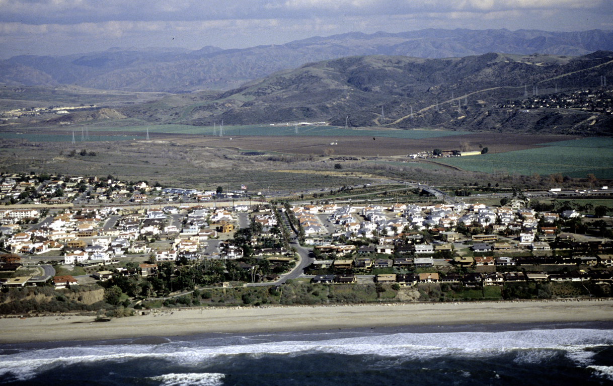
Cyprus Shores 1989

Cyprus Shores 2004

Cyprus Shores 2019

Cyprus Shores 2021
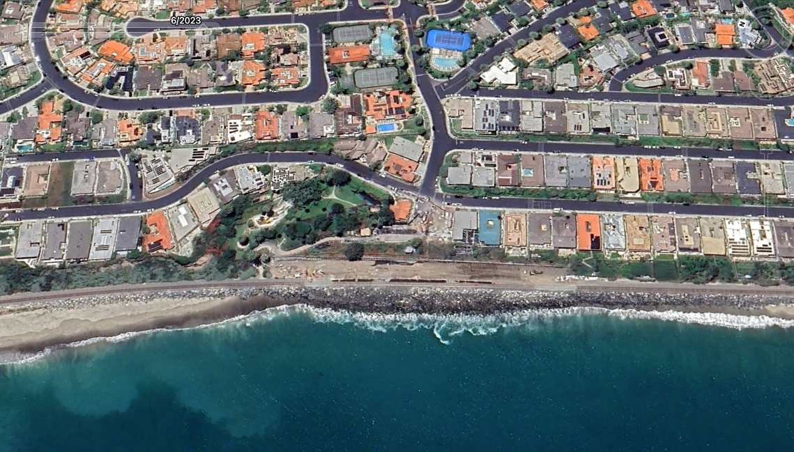
Cyprus Shores 2023
The image below illustrates the almost complete loss of beach between 2001 (blue line) and 2022 (black line) caused by erosion of an enormous volume of sand. The offshore zone in 2001/02 appears to have been smooth sandy bottom, in 2022 it appears to be bare rock. The question arises: where has the sand gone?
Since 2001: Width loss= 180 feet; elevation loss= 16 feet.

Below, data from UC-Irvine demonstrate the loss of beach width 1995-2021. The beach always varied greatly in width depending on the season. Historically, the sand that was lost offshore was always eventually replaced, until an event happened around 2015. According to Dr. Brett Sanders, the “tipping point” here was that the beach reached a critical width where storm waves began to crash against the railroad’s rock revetment, creating additional turbulence and increasing the rate of erosion. Currently there is not even wet sand at this location.


Gallery of historical photos from Cyprus Shores beach prior to 2015. (these are place-holders, need to get better ones, maybe about nine total).


Another gallery of photos, from now showing various aspects of the erosion and armoring.
