Rates of Erosion
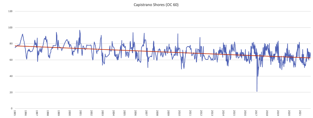
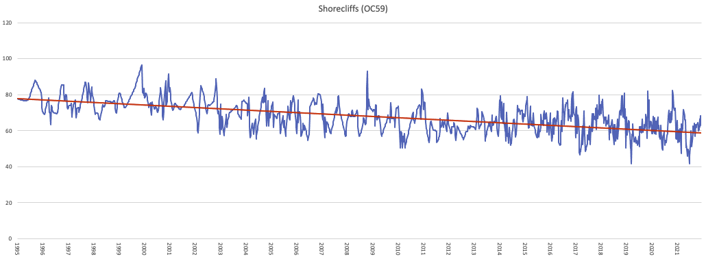
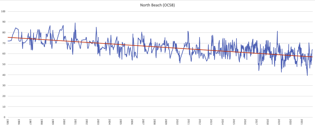
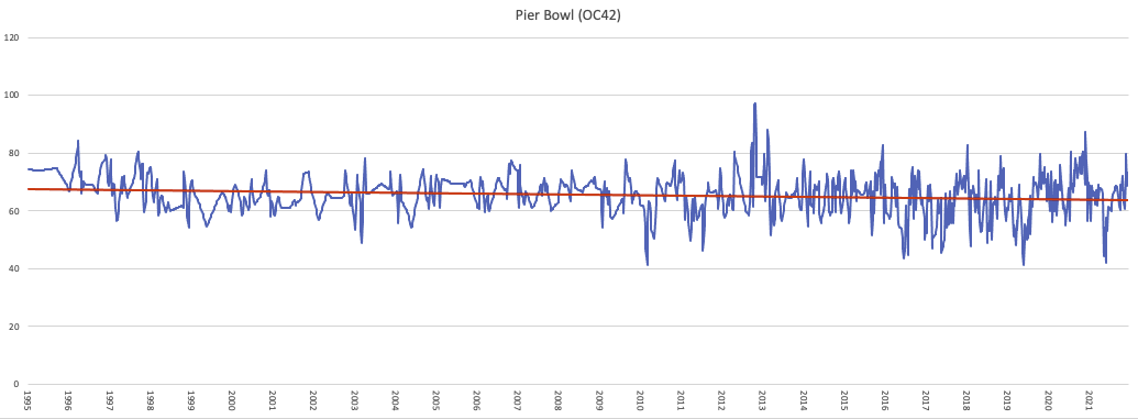
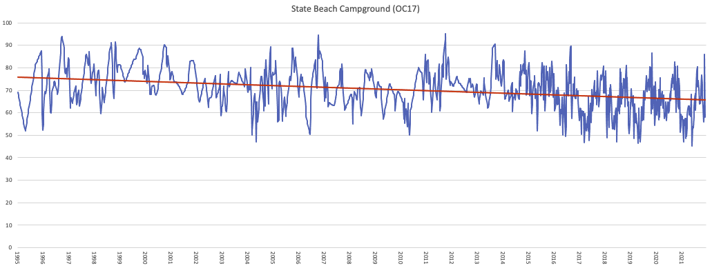
Below, data from UC-Irvine demonstrate the loss of beach width 1995-2021. The beach always varied greatly in width depending on the season — winter waves tend to move sand offshore and narrow the beach, while summer waves move the sand back onshore and the beach widens. Historically, most of the sand that was lost offshore was always eventually brought back — with some small amount of sand always lost offshore. Under natural conditions, the amount that was lost offshore would have been replaced with new supplies of sand from onshore sources. However, human activities have dramatically decreased the supply of sand to our coastline.
The regression lines (shown in red) for these data show the overall trend in beach width through time. These show that in general, there has been a gradual narrowing of most of the beaches. This is due to the lack of sediment supply.
The southern beaches (Cyprus Shores and Cottons) show a tremendous acceleration in the rate of erosion around 2013. According to Dr. Brett Sanders, the “tipping point” here was that the beach reached a critical width where storm waves began to crash against the railroad’s rock revetment, creating additional turbulence and increasing the rate of erosion.
The result at Cyprus Shores has been a complete loss of beach, with the system unable to recover on its own. Cottons has mostly had the same result. The accelerated erosion has been gradually moving northward, and can be seen on the graph for the south end of State Beach.
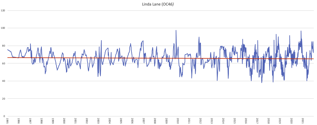
A few beaches have been shown to be relatively stable in width: Linda Lane, Pier Bowl, and T-Street. All of these beaches are fronted with rocky reef structures. The reefs serve to protect the beaches by attenuating the wave energy. Waves first break against the reef, and gradually lose energy before they hit the sandy beach, resulting in less erosion. (even if the wave doesn’t break over the reef, it still slows the wave and decreases its energy).